
 English
 Español
 Deutsch
 日本語
日本語 Polska
 Français
 中國
中國 한국의
한국의 Українська
 Italiano
 Nederlands
 Türkçe
 Português
 Bahasa Indonesia
 Русский
 हिंदी
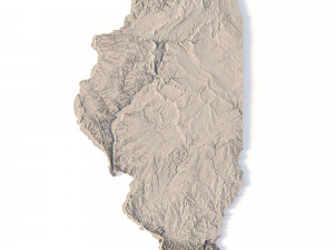
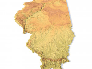
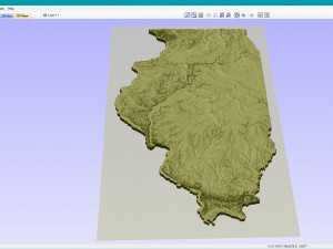
हिंदीIllinois Topographic Map STL Model 3D-printmodel


- Mogelijke formaten: Stereolithography: stl 524.90 MB
- Collectie:No
- Wijdte in millimeters:179
- Hoogte in millimeters:0.6
- Diepte in millimeters:320
- Afdruk Gereed:
- 3D-scan:No
- Volwassen:No
- PBR:No
- AI-training:No
- Aantal keer bekeken:1636
- Datum: 2022-06-17
- Item ID:402269
- Rating:
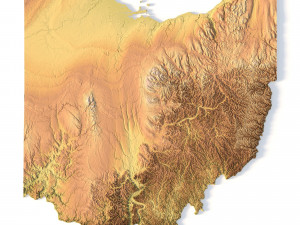
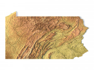
Create Detailed Illinois Terrain Models with This High-Resolution 3D STL
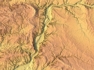
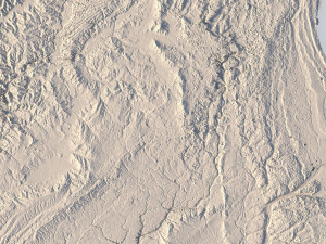
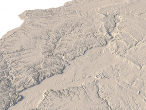
The Illinois Topographic Map STL model offers a high-resolution representation of the state’s topography and unique geographic features. This 3D model is ideal for creating physical relief maps from wood, metal, plastic, or concrete. Whether for educational purposes, landform visualization, or professional GIS projects, this model provides accurate elevation data for precise terrain modeling, compatible with 3D printers, CNC machines, and laser engravers.
- File size: 1.03 GB / 527 MB
- Model size: 178.8 mm x 319.62 mm x 0.566 mm
- Resolution: 0,06 mm
- Projection: Mercator
- Scaling factor: X — 1; Y — 1; Z — 3
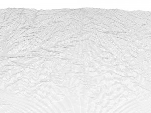
- Polygons: 22 126 420
- Vertices: 11 074 237
- Geometry: Polygonal Tris only
- Base: Open / Closed
Features of the Illinois Topographic STL Model
Accurate elevation data capturing Illinois’ varied landforms.
Compatible with FDM/SLA 3D printers for creating detailed terrain models.
Designed for CNC machining to craft wood or metal relief maps.
Supports high-precision laser engraving for metal surface detailing.
Als u een ander formaat nodig heeft, open dan alstublieft een nieuwe Support Ticket en vraag om een ander formaat. Wij kunnen uw 3D modelen van vorm veranderen naar: .stl, .c4d, .obj, .fbx, .ma/.mb, .3ds, .3dm, .dxf/.dwg, .max. .blend, .skp, .glb. We converteren geen 3D-scènes en formaten zoals .step, .iges, .stp, .sldprt.!


