
 English
 Español
 Deutsch
 日本語
日本語 Polska
 Français
 中國
中國 한국의
한국의 Українська
 Italiano
 Nederlands
 Türkçe
 Português
 Bahasa Indonesia
 Русский
 हिंदी
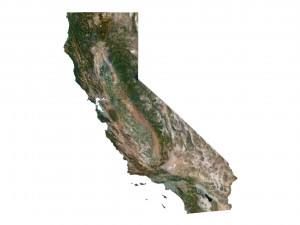
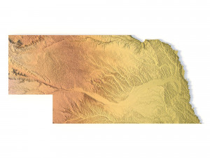
हिंदीTopographic California Map STL Model 3D-printmodel


- Mogelijke formaten: Stereolithography: stl 546.53 MB
- Collectie:No
- Wijdte in millimeters:457
- Hoogte in millimeters:5.4
- Diepte in millimeters:529
- Afdruk Gereed:No
- 3D-scan:No
- Volwassen:No
- PBR:No
- AI-training:No
- Aantal keer bekeken:1951
- Datum: 2022-06-17
- Item ID:402257
- Rating:
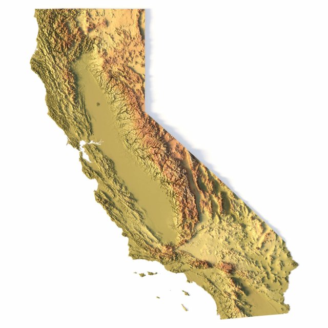
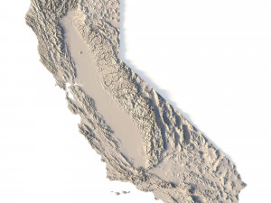
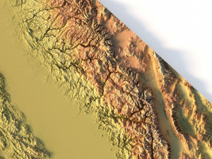
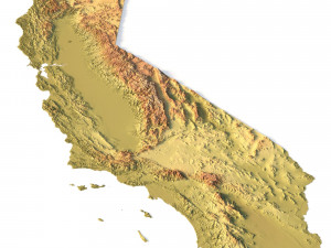
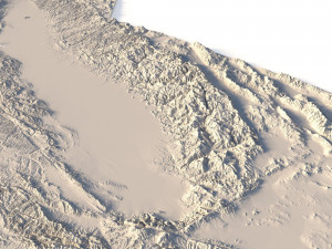
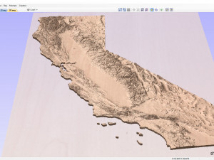
Create Detailed California Terrain Models with This 3D STL File
The Topographic California Map STL model provides a high-precision 3D terrain representation of the state. Whether you’re crafting topographic maps for landform visualization or working on professional geographic representation projects, this model captures the intricate elevation map details of California’s mountain ranges, valleys, and coastal features. Ideal for both hobbyists and professionals using 3D printers, CNC machines, and laser engravers.
- Files size: 1GB / 493 MB
- Model size: 114.35 mm x 132.2 mm x 1.341 mm
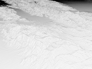
- Polygons: 14 394 280
- Vertices: 7 210 433
- Geometry: Polygonal Tris only
- Projection: Mercator
- Scaling factor: X - 0,0000001; Y - 0,0000001; Z - 0,0000003
- Base: Open/Closed
Key Features of the Topographic California Map STL Model
Compatible with FDM/SLA 3D printing for creating physical models of the terrain.
Designed for CNC machining on wood and metal materials.
Supports high-precision laser engraving for fine surface detailing on metals.
Als u een ander formaat nodig heeft, open dan alstublieft een nieuwe Support Ticket en vraag om een ander formaat. Wij kunnen uw 3D modelen van vorm veranderen naar: .stl, .c4d, .obj, .fbx, .ma/.mb, .3ds, .3dm, .dxf/.dwg, .max. .blend, .skp, .glb. We converteren geen 3D-scènes en formaten zoals .step, .iges, .stp, .sldprt.!


