English
 Español
 Deutsch
 日本語
日本語 Polska
 Français
 中國
中國 한국의
한국의 Українська
 Italiano
 Nederlands
 Türkçe
 Português
 Bahasa Indonesia
 Русский
 हिंदी
हिंदीColorado Map Topographic STL Model 3D-printmodel


- Mogelijke formaten: Stereolithography: stl 373.73 MB
- Collectie:No
- Wijdte in millimeters:312
- Hoogte in millimeters:5.4
- Diepte in millimeters:229
- Afdruk Gereed:No
- 3D-scan:No
- Volwassen:No
- PBR:No
- AI-training:No
- Aantal keer bekeken:1693
- Datum: 2022-06-17
- Item ID:402258
- Rating:
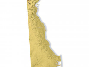
Create Detailed Colorado Terrain Models with This 3D STL
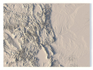
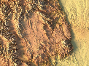
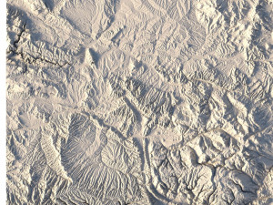
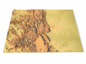
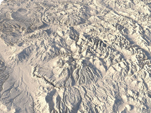
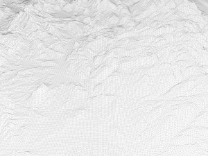
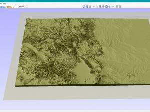
The Colorado Map Topographic STL model provides highly detailed terrain models of the state’s iconic landscape. Ideal for creating raised relief maps from materials like wood, metal, plastic, or concrete, this STL file is perfect for professionals and hobbyists interested in outdoor recreation, geospatial analysis, or landscape visualization. Whether for personal use or professional applications, this model brings the state’s varied landforms to life with precision elevation data.
- File size: 680 MB / 339 MB
- Model size: 312.4 mm x 228.9 mm x 5.374 mm
- Projection: Mercator
- Scaling factor: X — 1; Y — 1; Z — 3
- Polygons: 14 265 976
- Vertices: 7 138 442
- Geometry: Polygonal Tris only
- Base: Open / Closed
Features of the Colorado Topographic STL Model
Compatible with FDM/SLA 3D printing for creating physical models of the terrain.
Designed for CNC machines to carve terrain models from wood or metal.
High-resolution laser engraving for metal surfaces with precise topographic details.
Als u een ander formaat nodig heeft, open dan alstublieft een nieuwe Support Ticket en vraag om een ander formaat. Wij kunnen uw 3D modelen van vorm veranderen naar: .stl, .c4d, .obj, .fbx, .ma/.mb, .3ds, .3dm, .dxf/.dwg, .max. .blend, .skp, .glb. We converteren geen 3D-scènes en formaten zoals .step, .iges, .stp, .sldprt.!
Download Colorado Map Topographic STL Model 3D-printmodel stl Van sychev23021983
colorado usa state country map america artVerwante items Van Colorado Map Topographic STL Model